Saturday 28 December 2013

vectors!

Back when I first started my current research project one of the goals my boss mentioned was to see if we could determine "vectors of hydrothermal transport", or "what were the paths the hot water took as it dissolved some rock components and deposited others?".  As of today, more than two years after starting this project, I finally have an answer for that for one of the ingredients in my rocks.  Why did it take so long to get here?

Well, to start with, the data set the mine gave me is rather large, and the information within it was entered into the data base at a variety of different times, and the method in which the mine recorded the position of the drill holes changed at some point, so it took months to get the data "cleaned up" to the point that I could get all of the sample locations plotting in the correct space in 3D.

Then it was necessary to use "immobile element ratios" to determine what rock type each sample is. Why? Because in an area where lots of hot water flowed through the rocks picking up some elements and carrying them away while depositing others none of the rock has the same chemical composition as when it formed. However, there are certain elements that tend to stay put in the rocks, no matter how much hot water flows through it.  These are called "immobile elements".  Assuming that we are correct about them neither being taken away nor added to the rocks then the ratio between them won't change.  However, the actual percentage of the rock that is made up of the immobile elements changes greatly. Why?  Because when the other elements are dissolved and carried off that leaves a higher percentage of the “immobile elements” in the rock than it started with (but there is less rock in total). Likewise, when other elements are deposited into the rock it becomes diluted, and there is a lower percentage of the “immobile elements” left (and there is more rock than there was to begin with).  In reality, both of these processes are happening at once, sometimes a bit more of one, sometimes a bit more of the other, but either way, the end result is a rock that, at first glance, looks nothing like the original rock.

However, as I mentioned above the ratio between the “immobile elements” doesn’t change. Therefore, all the rocks of the same type should plot along a straight line in a graph which has one immobile element on one axis, and another on the other.  This fact is used to recognize the various rock types in the area.

Once all of the samples (more than 3,000 in my case) have been sorted into their various rock types the next step is to decide which sample within each rock type is the “least altered” sample—which one has a chemical composition that is closest to what the rock must have been before the hot water started circulating through the area?

From there, assuming that the “least altered” samples really are pretty much the same as they were to being with, it is a reasonably straightforward calculation to determine how each of the samples has changed with respect to their least altered samples. Once this has been done for every sample one has a table showing the amount of each element that was gained or lost within each sample.

This information is then taken into the 3D modelling program I am using, which looks at the location of each sample, and for a given element it can then look at how much of that element each sample gained or lost, and then it goes a step further and makes an educated guess as to how the areas between the samples must have also changed, assuming a regular pattern.

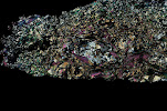
I have been at this stage for a while now, and have created lovely figures showing which areas had the greatest gain in a given element, which adjacent areas had slightly less gain, which areas had no change, which areas had a little loss of that element, which areas had a greater loss, and so on.

But what I didn’t have was the “vectors”—the nice little arrows one can draw to say that the highs are here, and the lows are there, and this is the path from here to there.  Today, at long last, I discovered a way to get that using the 3D drawing capabilities within the program.  “All” one has to do is first rotate the full 3D models around on the screen, setting the various layers to various states of transparency, until one is satisfied one knows where one wants to draw the line.

Then add a “plane” to the screen that goes through the area one will want to draw the line. If it happened to appear in the correct spot in the first place, rejoice.  However, it is more likely that it will need adjusting.  There are several options for this—one can grab one of the “handles” provided by the program, and attempt to drag the plane up, down, left, or right, until it sits where one wants it to sit (don’t forget to rotate the image on the screen and look at it from multiple directions to be certain it really is where you think it is!). This is even harder to do than it sounds.  Another option is to turn off the plane and try again from the beginning. The third option is to look at the numerical coordinates for the plane and edit them.  This one can be the best option. If you happen to have a sample located near where you want the center of the plane then you can click on the sample to determine its X, Y, and Z coordinates, then type those into the location of the plane. Once it is centered where you want it you can then change the dip and the dip azimuth until it is oriented correctly.

Once you are happy with the location of the plane then add the “slicer” to the screen, and edit the coordinates of the slicer until it is in the exact same position as the plane.  Then you can rotate the screen until you are looking at the flat of the plane (and slicer).  At that point it is possible to add a “poly line”, drawing it from the area with the greatest loss in that element to the area of the greatest gain in that element (note: it helps if you have first set the 3D model to have the front half removed by the slicer—that way when you look at the plane of the slicer what you are seeing is the concentric shells of the model, so that you can draw that line).  Such poly lines automatically appear in the plane of the slicer, which is why those set-up steps were necessary.

Rotate the screen, did you get the line where you wanted it? Yup! Great. Go on to the next fault block and repeat the process from the beginning.  Tedious? Yah. Cool to be able to add lines in 3D? Absolutely!

One more goal achieved, and the clock is ticking—the project officially ends with the end of this year…


Monday 23 December 2013

plants: cover or clue?

I haven’t played along with the Accretionary Wedge game in quite a while, but when I saw this month’s topic “rocks and plants” memories of my undergraduate field lessons sprang into my mind at once, so I knew it was time to share.

There are times in every geologist’s life where we start to resent the “cover” that plants and soil represent—when important contacts are obscured. When there are no rocks to be seen for many miles around. On the other hand, sometimes plants are a useful clue.  I remember when I was an undergraduate student on a field trip our teacher taught us to recognize his favourite plant, Aspidotis densa, a fern which likes magnesium in its diet, and so tends to grow on serpentine rich soils.  He worked in southern Oregon (and northern California), an area which often has serpentine located within fault zones.  In fact he said that many geologists he knows working in that area are inclined to put a fault on their map when doing field work if the only clue they see is a single outcrop of serpentine.  By extension, in areas with heavy vegetation and no rock outcrop whatsoever, if they see aspidotis densa they make a note of it, because it could mean there is serpentine present, and therefore this could be a fault zone, and they look for other clues (is there a spring that comes to the surface nearby also?).

It has been many years since I was an undergrad, I haven’t done mapping in that part of the world for a very long time, yet I had never forgotten the name of that plant, and, because I learned about it when I was young and impressionable, I always remember to ask local geologists when I come to a new area if there are any important local plants I ought to be able to recognize because they only grow on a specific soil type, and thus give clues to the geology they cover.

Tuesday 8 October 2013

I think I have a new favourite rock type

I spent most of last week at the Metamorphic Geology Field Symposium in Halland, SW Sweden, and can enthusiastically say that this was the best field trip/short course/conference I have ever attended. The outcrops were stunning, the lectures fascinating, and the discussions engaging.  All in all I am very, very inspired to pursue research in metamorphic geology once again. The project I have been working on for the better part of the past two years is tangentially related to metamorphic petrology (the rocks have undergone metamorphism, but that is not terribly relevant to the project goals), and it has been interesting, but from here on out I would like to have my research even more closely aligned with my metamorphic interests. But that is not what I am here to talk to you about.
Kyanite eclogite!  There is a place in the south west corner of Sweden where there are lenses and layers of kyanite-bearing eclogite within a deformation zone. The zone is, specifically, the Gällared Zone, which, they tell me, is the northeastern most part of the Ullared Deformation zone as defined by Möller et al (1997).

Due to the deformation in this area some of the eclogite has been transformed into high temperature mylonitc gneiss, but there are still a number of areas where the eclogite itself has survived. Within these areas are veins where the kyanite is so abundant that instead of being a green-red normal eclogite the rock is a striking blue-red combination that is so beautiful I thought it worth taking the time to put my fingers to keyboard and do some bloging for the first time in months.
The field guide for the trip tells me that the presence of kyanite in rocks that have experienced eclogite facies metamorphism indicates that the pressures would have been greater than 15 kbar at a temperature of 700 C, and the paper by Möller (1998) contains a great deal more information about the composition of the various minerals in these rocks and what those compositions mean in terms of the temperature and pressure at which they formed.


REFERENCES:

Möller , C., Andersson, J., Söderlund, U., and Johansson, L., 1997: A Sveconorwgian deformation zone (system?) within the Eastern Segment, Sveconorwegian orogen of sw Sweden – a first report. GFF 119, 73-78. DOI: 10.1080/11035899709546457 

Möller C (1998) Decompressed eclogites in the Sveconorwegian (-Grenvillian) orogen of SW Sweden: petrology and tectonic implications. Journal of Metamorphic Geology 16 (5):641-656

Tuesday 26 February 2013

luckily, my geo-injuries have been minor


When I first saw the call for Accretionary Wedge 55 I couldn't think of any injuries I had gotten in the field, and closed the tab on my browser and thought nothing more of it. However, today, reading some other reports of minor injuries, I suddenly remember a rock-related owie.

I was an undergraduate geology student, living in southern Oregon. My boyfriend at the time decided that since I liked rocks and was new to that part of the country he should take me on an adventure to the Lava Beds National Monument to do some caving in the lava tubes there.  As far as dates to take geologists go, this was a very good idea.

So there we were, wandering through a lava cave, the only light coming from my headlamp and his flashlight. He scampered up a small pile of lose rocks, each perhaps 10 to 20 cm in diameter, and I started to follow. However, in so doing I discovered that the density of vesicular chunks of lava is very different from the more solid rocks I had encountered elsewhere, and as a result they rocks shifted under my feet in a very unexpected manner.  I lost my balance and fell forward, catching myself on my hands.

In the process the little finger of my left hand got caught between two rocks. When I called out, more in surprise than pain at that point, my boyfriend returned to my side, asked to look at my hand to see if it was ok, and, seeing that my little fingernail had split lengthwise, and that the outer portion was pointing off at a wrong angle, decided that the time to fix it was before I noticed that it hurt, so he grabbed my hand and pushed the nail back where it was meant to be. That got me to exclaim in pain!

That pretty much cut short the adventure part of the day—instead of exploring further we went back to the visitor center, cleaned the wound and got it bandaged up.  Thanks to his prompt re-alignment of my finger nail the wound healed cleanly, and I never lost any nail, though it had a bit of a seam running the length of it for a few weeks.

Monday 18 February 2013

Book Review: Metasomatism and the Chemical Transformation of Rock


Last April I heard about a soon to be released textbook that sounded very interesting and useful to my current research project: Metasomatism and the Chemical Transformation of Rock, edited by Daniel E. Harlov and Håkon Austreheim (published by Springer).  I checked out their web page, and saw that it would be possible to obtain a copy for review, so I filled in the form and sent it in.  In September I received an email letting me know how to access my copy on line, and I have been happily reading my way through the book (in between my other duties) ever since.  Now that I have (mostly) completed the reading, it is time to sit down and type up the review.

First of all, I am pleased to note that sometime between when last I read a textbook and picking up this one the fashions in how they are organized seems to have changed—this book starts with a chapter that summarizes what can be found in all of the subsequent chapters. I think I like this new trend, since it makes it easier for a busy person to decide which chapters they actually need to read based on what is and is not relevant to their own research.

The introductory chapter also provides a concise, clear, definition of metasomatism and an explanation of how it is both related to and different from metamorphism.  Metamorphism refers to the changes in rocks due to changes in physical conditions (primarily heat and pressure) which may or may not involve a change in composition of the rock. This is a subject I am well versed in, having done metamorphic research in one form or another for more than seven years now. Metasomatism, on the other hand, refers to changes in the composition rock due to interactions with an aqueous fluid, which picks up some elements and deposits others.  This is clearly related to metamorphism, but while they overlap, they are not the same.  It is also the major process affecting the rocks in my current research area, which is why I was so happy to see the book come out just now.


For the most part I have been very happy with this book—it takes a variety of different threads and ties them together in an easy to understand package.  Indeed, I have so enjoyed some of the discussions that I have taken longer to read the full book than I might otherwise have, since I stopped so often to look up and read references cited—something I don’t recall ever doing when I was an undergraduate student reading textbooks because they were required for a class.  

The list of chapter authors includes names that will be familiar to anyone who has been reading papers that address aspects of metasomatism (see above link for the table of contents). My personal favourite chapters were the ones on thermodynamic modelling, the effects of metasomatism on their host rocks, and on geochronology.  I found the one on thermodynamic modelling fascinating since I am already familiar with doing that for metamorphic rocks, and it was interesting to read about what needs to be considered when one assumes that the bulk rock composition DID change, as it does with metasomatism, but as it does not (necessarily) do with metamorphism. The chapter on effects is particularly useful for me because this is information I need for my current research, and I enjoyed the geochronology one because I did a fair bit of geochronology for metamorphic rocks for my PhD research, and it is interesting to see how one approaches it differently for metasomatic environments.  

I did notice some minor issues with the editing on a grammatical level, which surprised me, since I would have assumed that a major publisher would have good editors on staff whose job it is to prevent such things. They were just little things that caught my eye and grated a bit on my nerves as being awkward and clunky (I think that the phrase "…presence or not of fluids" should have been written "…presence or absence of fluids”).  However, such details do not actually detract from the content, which I am finding to be very useful.


I am also pleased to pass on the news that the authors of this book have recently presented a short course at the 2012 Goldschmidt conference.  They have shared the pdfs of their presentations for this course on line.  I would have loved to have attended the workshop, but since I wasn’t able to make it to the conference I am delighted that they have this handout available—it appears to compliment the book very well.


Friday 15 February 2013

Three broad roads a geologist might travel during their career


There are several different paths a geologic career might take: academia, exploration, or environmental/risk. Which one is best for you will depend on your personality type.

A geologist in academia is usually someone who studies rocks to better understand the information recorded in them—how and why did they achieve their present composition and/or configuration?  They start with what they know: the rock is located here and looks like this, and extrapolate from clues within the rock to determine how it got there, and why, and when, and what happened to it along the way.

An exploration geologist, on the other hand, is looking for something (often oil or mineral resources).  They don’t know where their commodity is located, so they study locations where similar such resources have already been found to look for patterns to the rock structure and/or composition that they may be able to recognize elsewhere and so find what they seek in a new location.

The third category of geologists the environmental sector and/or risk management.  Their job is to understand the dangers which are present in our world, and look for ways to prevent those dangers from becoming problems.  They start with the facts that are known (e.g. the presence of contaminants in the ground water at point A, zones of weakness in rock that could lead to landslides, or the location of an active fault or volcano) and play “what if” games to determine how much (or what manner of) danger these present to the people in those areas.

So, which are you? Are you more interested in asking question of “how/why/when”?  Do you want to know “where”, or are you more concerned with “what if/how can I help”?

For myself I am pleased to be in the academic track—I want to better understand the world around me. I am not interested in playing games of hide and seek—I don’t even care to go shopping because I don’t enjoy trying to figure out where to find something I need is located.  Often the stores don’t even carry what I want and I waste valuable time looking for it, a parallel which is probably all too familiar to exploration geologists—not every search they undertake leads them to a discovery.  However, I suspect for those who do enjoy a good search there is an extra reward in terms of satisfaction when their work does lead them to what they seek.  

I am also far more interested in understanding how the rocks got to where they are now than I am in understanding what dangers they present to humans.  While I am very aware that it is vital that someone is working to keep contaminants out of ground water, or tracking them once they are there so that no one is using the bad water, I don’t want it to be me.  While I am grateful that I know enough not to build my house right on top of a fault zone or in the path of a potential landslide, I don’t wish to be the one who has to warn others about these dangers.  Adding in a human element presents all kinds of extra challenges and complications that I am happy to leave to others.  But my biases are not yours, and you are likely to have different interests and different reasons to find one of these paths more or less appealing than the others.

Thursday 17 January 2013

A challenging way to write


I was inspired by Ann and Chris over at HighlyAllotchthonous to try to write up what I study using a text editor which limits one to using only the 1000 most commonly used words.

Here follows my attempt to describe metamorphic petrology and 3D models of hydrothermal alteration systems using none of those words:

I study rocks that have changed because they got hot or because too many other rocks were on top of them. The bits that make up rocks can change quite a lot because of just how hot it is, and also because of how much stuff is on top of it.  Different bits of rock like to give away some the stuff they are made of when they get hotter (and/or they go deeper under other rocks), and instead take different stuff from other rock bits.  Studying which stuff appears more in one rock bit than another rock bit can tell us just how hot or how deep the rock must have been. 

Another thing which can make rocks change is water. When hot water moved through the cracks in rocks it can help carry stuff between the rock bits.  My job today studies rocks that had water help them to change, and I am trying to make a drawing that shows all of the changes as they happened-a drawing that one can look at from any side: top, bottom, left, right, front or back. When the drawing is done you will be able to turn it any way you want and see how the rocks have changed.